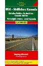
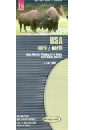
usa southern canada 1 4 000 000
Модель:
RUR 548
USA. Southern Canada. 1:4 000 000. Touristische Informationen. Ortsregister mit Postleitzahlen. Entfernungen in km.
Модель:
RUR 937
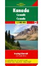
Explore Canada with this Freytag&Berndt double-sided road map. The best way to plan your trip, prepare your itinerary, and to travel independently in this country. One side shows Western Canada: British Columbia, the Prairies, Yukon, and the North-West Territories, and the other side shows Ontario, Quebec, and Atlantic Canada. Touristic information: airports, national parks, places of interest.
Модель:
RUR 937
This map appears in the map series world mapping project in travel expertise. Characteristic is the high-quality, clear and modern cartographic representation. Contour lines with elevation Coloured elevation levels Classified road network with distances Places of interest Detailed local index GPS capability by longitude and latitude UTM grid.
Модель:
RUR 1164
This map appears in the map series world mapping project ™ in travel expertise. Characteristic is the high-quality, clear and modern cartographic representation. Contour lines with elevation Coloured elevation levels Classified road network with distances Places of interest Detailed local index
Модель:
RUR 608
This map appears in the map series world mapping project in travel expertise. Characteristic is the high-quality, clear and modern cartographic representation. Contour lines with elevation Coloured elevation levels Classified road network with distances Places of interest Detailed local index
Модель:
RUR 1144
This map appears in the map series world mapping project in travel expertise. Characteristic is the high-quality, clear and modern cartographic representation. Contour lines with elevation Coloured elevation levels Classified road network with distances Places of interest Detailed local index GPS capability by longitude and latitude UTM grid
Модель:
RUR 666
This map appears in the map series world mapping project in travel expertise. Characteristic is the high-quality, clear and modern cartographic representation. Contour lines with elevation Coloured elevation levels Classified road network with distances Places of interest Detailed local index GPS capability by longitude and latitude UTM grid
Модель:
RUR 1435
The trekking map of the High Atlas at 1:100 000 includes the region of Jebel Toubkal - the highest peak of Morocco and also the ski station of Oukaimiden. The map also includes a road and tourist map at 1:1 500 000 (1:3 000 000 for Southern Morocco) of the whole country showing tourist attractions. There is also a street plan Marrakech at 1:20 000.
Модель:
RUR 500
This map appears in the map series world mapping project in travel expertise. Characteristic is the high-quality, clear and modern cartographic representation. Contour lines with elevation Coloured elevation levels Classified road network with distances Places of interest Detailed local index GPS capability by longitude and latitude UTM grid
Модель:
RUR 823
This map appears in the map series world mapping project in travel expertise. Characteristic is the high-quality, clear and modern cartographic representation. Contour lines with elevation Coloured elevation levels Classified road network with distances Places of interest Detailed local index GPS capability by longitude and latitude UTM grid

Модель:
RUR 937
This map appears in the map series world mapping project in travel expertise. Characteristic is the high-quality, clear and modern cartographic representation. Contour lines with elevation Coloured elevation levels Classified road network with distances Places of interest Detailed local index GPS capability by longitude and latitude UTM grid
Модель:
RUR 750
This map appears in the map series world mapping project in travel expertise. Characteristic is the high-quality, clear and modern cartographic representation. Contour lines with elevation Coloured elevation levels Classified road network with distances Places of interest Detailed local index GPS capability by longitude and latitude UTM grid

Модель:
RUR 738
Бестселлер № 1 по версии The New York Times и USA Today. Кассандра Клэр - автор бестселлеров № 1 по версии The New York Times, USA TODAY, Wall Street Journal и Publishers Weekly. Ее книги переведены на 35 языков. В мире продано более 35 000 000 экземпляров ее книг. cassandraclare.com
Модель:
RUR 728
This map appears in the map series world mapping project in travel expertise. Characteristic is the high-quality, clear and modern cartographic representation. Contour lines with elevation Coloured elevation levels Classified road network with distances Places of interest Detailed local index GPS capability by longitude and latitude UTM mark on the edge of the map
Модель:
RUR 548
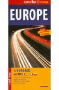
This easy-folding laminated comfort! map is durable and water resistant. Map includes up-to-date road network, places of interest, shaded relief and an index of places names. Double sided map.